
Finding the safest route for Memphis isn’t just about avoiding traffic—it’s about minimizing risks from crime, poor road conditions, and unpredictable weather. This guide breaks down data-driven strategies, neighborhood insights, and real-time tools to help you travel confidently through the city.
In This Article
- 1 Key Takeaways
- 2 📑 Table of Contents
- 3 Introduction: Why Safety Matters When Driving in Memphis
- 4 Understanding Memphis: Geography, Traffic, and Crime Patterns
- 5 Tools and Apps to Find the Safest Route for Memphis
- 6 Best Practices for Safe Driving in Memphis
- 7 Neighborhood-by-Neighborhood Safety Guide
- 8 Seasonal and Event-Based Route Considerations
- 9 Conclusion: Your Safety Is in Your Hands
- 10 Frequently Asked Questions
- 10.1 What is the safest route for Memphis during rush hour?
- 10.2 Are there neighborhoods in Memphis I should avoid driving through?
- 10.3 How can I check for road closures or accidents in Memphis?
- 10.4 Is it safe to drive in Memphis at night?
- 10.5 What should I do if I break down on the highway in Memphis?
- 10.6 Are there safer alternatives to driving in Memphis?
Key Takeaways
- Use real-time navigation apps: Google Maps and Waze provide live updates on accidents, police presence, and road closures, helping you avoid unsafe areas.
- Avoid high-crime zones during late hours: Areas like Orange Mound and parts of Frayser have higher crime rates, especially after dark—plan routes to bypass them when possible.
- Stick to well-lit, major roadways: Highways like I-40 and I-240 and main streets such as Poplar Avenue and Union Avenue are better maintained and patrolled.
- Check weather and road conditions: Memphis experiences sudden thunderstorms and flooding—apps like Weather.com and local DOT alerts can help you reroute safely.
- Plan ahead for peak traffic times: Rush hour (7–9 AM and 4–6 PM) increases accident risks; leaving early or using alternate routes can reduce stress and danger.
- Stay informed with local crime maps: Websites like SpotCrime and the Memphis Police Department’s online dashboard show recent incidents to help you avoid trouble spots.
- Consider time of day and purpose of travel: A route safe for a daytime commute might not be ideal for a late-night return—adjust your path based on context.
📑 Table of Contents
- Introduction: Why Safety Matters When Driving in Memphis
- Understanding Memphis: Geography, Traffic, and Crime Patterns
- Tools and Apps to Find the Safest Route for Memphis
- Best Practices for Safe Driving in Memphis
- Neighborhood-by-Neighborhood Safety Guide
- Seasonal and Event-Based Route Considerations
- Conclusion: Your Safety Is in Your Hands
Introduction: Why Safety Matters When Driving in Memphis
Memphis, Tennessee, is a city rich in culture, music, and Southern charm. From the soulful sounds of Beale Street to the quiet beauty of Overton Park, there’s plenty to explore. But like any major urban area, navigating Memphis safely requires more than just knowing the streets—it demands awareness of traffic patterns, crime trends, and environmental factors that can affect your journey.
When people ask, “What is the safest route for Memphis?” they’re often thinking about avoiding traffic jams or construction zones. But true safety goes deeper. It’s about choosing paths that minimize exposure to crime, reduce the risk of accidents, and keep you confident behind the wheel. Whether you’re commuting to work, visiting family, or exploring the city for the first time, understanding how to identify and follow the safest route can make all the difference.
Understanding Memphis: Geography, Traffic, and Crime Patterns
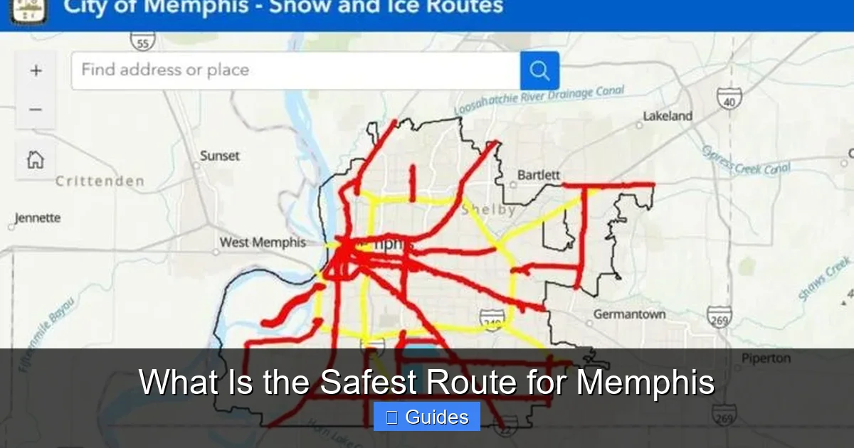
To determine the safest route for Memphis, it helps to understand the city’s layout and key risk factors. Memphis spans over 300 square miles along the Mississippi River, with a mix of urban cores, suburban neighborhoods, and industrial zones. Major highways like I-40, I-55, and I-240 form the backbone of the city’s transportation network, connecting downtown to outlying areas like Germantown, Bartlett, and Collierville.
Visual guide about What Is the Safest Route for Memphis
Image source: dollarsanity.com
Traffic Hotspots and Congestion Zones
Memphis experiences moderate to heavy traffic, especially during weekday rush hours. The most congested areas include the I-40/I-240 interchange near downtown, the stretch of I-55 leading into the city from the south, and Poplar Avenue through Midtown. These zones aren’t just frustrating—they’re also high-risk for fender benders and aggressive driving.
For example, the I-40 corridor between Exit 1A (Danny Thomas Blvd) and Exit 3 (Union Ave) sees frequent slowdowns due to merging traffic and construction. During peak times, speeds can drop below 20 mph, increasing the chance of rear-end collisions. Using alternate routes like Sam Cooper Boulevard or East Parkway can help you avoid these bottlenecks while staying on well-maintained roads.
Crime and Neighborhood Safety
Crime is a significant factor when evaluating the safest route for Memphis. According to the Memphis Police Department’s 2023 crime report, certain neighborhoods experience higher rates of violent crime and property theft. Areas like Orange Mound, parts of Frayser, and sections of South Memphis have reported increased incidents, particularly after sunset.
This doesn’t mean these areas are off-limits, but it does mean drivers should be extra cautious—especially when traveling alone or at night. Avoiding shortcuts through poorly lit residential streets or abandoned industrial zones can significantly reduce your risk. Instead, opt for main thoroughfares that are regularly patrolled and have better lighting.
Weather and Environmental Risks
Memphis is no stranger to severe weather. Spring and summer bring frequent thunderstorms, heavy rain, and occasional tornado warnings. Flash flooding is a real concern, especially in low-lying areas near the Wolf River and along the Mississippi floodplain. Roads like Riverside Drive and parts of Mud Island can become impassable during heavy downpours.
Winter weather is less common but can still pose hazards. Ice storms, though rare, can make roads slick and dangerous. Always check the National Weather Service forecasts before heading out, and consider delaying travel during severe alerts.
Tools and Apps to Find the Safest Route for Memphis
Thankfully, modern technology makes it easier than ever to find the safest route for Memphis. Navigation apps don’t just give you directions—they analyze real-time data to help you avoid danger.
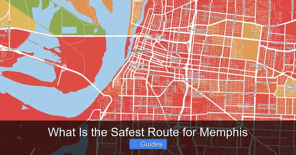
Visual guide about What Is the Safest Route for Memphis
Image source: images.crimegrade.org
Google Maps: More Than Just Directions
Google Maps is one of the most popular tools for drivers, and for good reason. It uses live traffic data, user reports, and historical patterns to suggest the fastest and safest routes. When you input your destination, the app considers accidents, road closures, police activity, and even construction zones.
For example, if there’s a reported shooting near Lamar Avenue and Walker Avenue, Google Maps may reroute you via Elvis Presley Blvd or Airways Blvd to keep you away from the area. The app also shows street views and satellite imagery, helping you preview neighborhoods before you arrive.
Waze: Community-Powered Safety
Waze takes real-time navigation a step further by relying on user-generated reports. Drivers can report accidents, speed traps, potholes, and even suspicious activity. This crowdsourced data makes Waze especially useful for avoiding sudden hazards.
Imagine you’re driving down I-240 and a Waze user reports a stalled vehicle in the left lane. The app will alert you and suggest a lane change or alternate route before you reach the obstruction. This kind of proactive warning can prevent accidents and reduce stress.
Local Crime and Traffic Alerts
Beyond navigation apps, consider using local resources to stay informed. The Memphis Police Department offers a free online crime map that updates daily with reported incidents. You can filter by type (theft, assault, vandalism) and location to see if your planned route passes through a high-risk zone.
Additionally, the Tennessee Department of Transportation (TDOT) provides real-time traffic cameras and road condition updates through its SmartWay app. This is especially helpful during winter weather or major events like the Memphis in May festival, when traffic patterns shift dramatically.
Best Practices for Safe Driving in Memphis
Even with the best tools, safe driving comes down to personal habits and awareness. Here are some practical tips to help you stay secure on Memphis roads.
Visual guide about What Is the Safest Route for Memphis
Image source: galerie-com.com
Plan Your Route in Advance
Don’t wait until you’re behind the wheel to figure out where you’re going. Take a few minutes before leaving to review your route using Google Maps or Waze. Look for potential trouble spots—construction zones, school areas, or neighborhoods with recent crime reports—and decide whether to adjust your path.
For instance, if you’re driving from East Memphis to Downtown, you might consider taking Poplar Avenue instead of I-240 during rush hour. Poplar is a surface street with traffic lights, but it’s often faster and safer than dealing with highway congestion and merging traffic.
Drive Defensively, Not Aggressively
Memphis drivers can be unpredictable. Some speed through yellow lights, while others hesitate at green ones. The key is to stay calm and drive defensively—anticipate the actions of others and give yourself plenty of space.
Keep a safe following distance (at least three seconds behind the car in front of you), use your turn signals early, and avoid sudden lane changes. If someone is driving erratically, let them pass. Your goal isn’t to win the road—it’s to get home safely.
Stay Alert at Night
Driving at night increases your risk of accidents and encounters with crime. Visibility is reduced, and fatigue can set in quickly. To stay safe, avoid distractions like texting or adjusting the radio. Keep your headlights on, and use high beams when appropriate (but dim them for oncoming traffic).
If you’re traveling through an unfamiliar area after dark, stick to major roads with streetlights and regular traffic. Avoid shortcuts through alleys, parking lots, or quiet side streets unless you’re certain they’re safe.
Be Prepared for Emergencies
Even on the safest route for Memphis, things can go wrong. Always carry a roadside emergency kit with a flashlight, jumper cables, a first-aid kit, and a charged phone. Keep your gas tank at least half full, especially during long trips or extreme weather.
If you’re involved in an accident or break down, pull over to a well-lit, populated area if possible. Call 911 for emergencies or use the Memphis Non-Emergency Line (901-636-6666) for minor incidents. Stay in your vehicle with the doors locked until help arrives.
Neighborhood-by-Neighborhood Safety Guide
Not all parts of Memphis are created equal when it comes to safety. Here’s a quick breakdown of key areas to help you plan your route wisely.
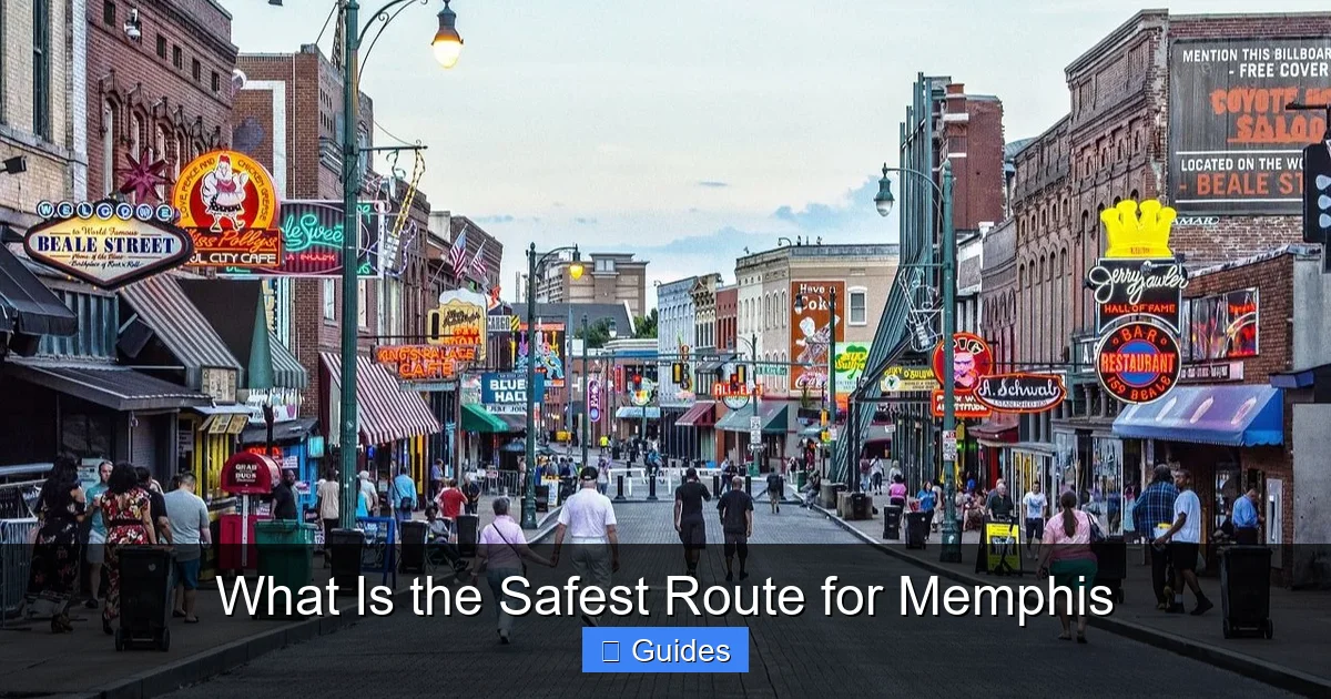
Downtown Memphis
Downtown is generally safe during the day, especially around Beale Street, FedExForum, and the Riverfront. However, some blocks near South Main and Lauderdale can feel isolated at night. Stick to well-populated areas and avoid walking alone in dimly lit alleys.
For drivers, I-40 and I-55 provide quick access, but be mindful of pedestrians and cyclists, especially near the Big River Crossing. Parking garages are safer than street parking after dark.
Midtown
Midtown, home to Overton Park and the Memphis Zoo, is a vibrant, family-friendly area. Streets like Union Avenue and McLean Boulevard are well-lit and regularly patrolled. This is one of the safer zones for both day and night travel.
Avoid side streets near Lamar Avenue in certain sections, especially after 10 PM. Stick to main roads and use caution when turning across traffic.
East Memphis
East Memphis is one of the city’s most affluent and safest neighborhoods. Areas around Poplar Avenue, Walnut Grove, and Kirby Parkway have low crime rates and excellent road conditions. This is an ideal route for commuters and families.
The Poplar Corridor (between I-240 and Germantown) is a major artery with shopping centers, restaurants, and medical facilities. It’s well-maintained and rarely experiences traffic issues outside of peak hours.
North Memphis and Frayser
These areas have faced economic challenges and higher crime rates in recent years. While not universally dangerous, certain blocks—especially near Elvis Presley Blvd and Airways Blvd—should be approached with caution, particularly at night.
If you must travel through North Memphis, use I-40 or I-55 and avoid surface streets unless absolutely necessary. Keep your doors locked and windows up.
South Memphis
South Memphis has a rich cultural history but also struggles with crime in some neighborhoods. Areas near South Parkway and Lamar Avenue should be avoided after dark. However, the Soulsville neighborhood (home to Stax Museum) is seeing revitalization and is generally safe during daylight hours.
Use I-55 or I-240 to bypass the area when possible, or travel with a group if you must go through.
Germantown and Collierville
These suburban communities are among the safest in the Memphis metro area. With low crime rates, excellent schools, and well-maintained roads, they’re ideal for families and long-term residents.
Routes like Poplar Avenue, Germantown Parkway, and Highway 72 are smooth, wide, and rarely congested. These areas are also well-lit and patrolled, making them some of the safest routes for Memphis.
Seasonal and Event-Based Route Considerations
Memphis hosts numerous events throughout the year that can impact traffic and safety. Planning around these can help you avoid crowds and potential risks.
Memphis in May
This month-long festival includes the Beale Street Music Festival and the World Championship Barbecue Cooking Contest. Downtown and Tom Lee Park become extremely crowded, with road closures and heavy pedestrian traffic.
If you’re not attending, avoid the downtown core during event weekends. Use alternate routes like Sam Cooper Blvd or I-40 to bypass the area. If you must go downtown, arrive early and park in a secure garage.
University of Memphis Events
Game days at the Liberty Bowl or football games at the University of Memphis can cause major traffic delays. Streets like Central Avenue and Highland Street become congested, and parking is limited.
Plan to leave early or use public transportation. The MATA trolley system offers a safe, stress-free way to reach campus events without dealing with traffic.
Holiday Travel
Thanksgiving, Christmas, and New Year’s Eve bring increased traffic and higher accident rates. Many drivers are fatigued, distracted, or under the influence.
During holidays, stick to familiar routes and avoid driving late at night. If you’re traveling long distances, consider leaving a day early to avoid rush-hour crowds.
Conclusion: Your Safety Is in Your Hands
So, what is the safest route for Memphis? The answer isn’t a single road or highway—it’s a combination of smart planning, real-time awareness, and defensive driving. By using navigation apps, avoiding high-risk areas, and staying informed about local conditions, you can significantly reduce your chances of encountering danger.
Remember, safety isn’t just about avoiding accidents—it’s about feeling confident and in control behind the wheel. Whether you’re a daily commuter or a first-time visitor, taking the time to plan your route can make your journey smoother, faster, and far more secure. Memphis has so much to offer, and with the right approach, you can explore it all with peace of mind.
Frequently Asked Questions
What is the safest route for Memphis during rush hour?
The safest route for Memphis during rush hour often involves avoiding major interchanges like I-40/I-240. Consider using surface streets such as Poplar Avenue or Sam Cooper Boulevard, which are less congested and better lit. Always check real-time traffic apps before leaving.
Are there neighborhoods in Memphis I should avoid driving through?
Some areas like parts of Frayser, Orange Mound, and South Memphis have higher crime rates, especially at night. While not all blocks are dangerous, it’s wise to stick to main roads and avoid shortcuts through poorly lit or isolated streets after dark.
How can I check for road closures or accidents in Memphis?
Use apps like Google Maps, Waze, or the TDOT SmartWay app to get real-time updates on road closures, accidents, and construction. The Memphis Police Department also posts incident reports online, which can help you avoid trouble spots.
Is it safe to drive in Memphis at night?
Driving at night in Memphis can be safe if you stick to well-lit, major roadways and avoid high-crime areas. Always keep your doors locked, stay alert, and use navigation apps to reroute around reported incidents.
What should I do if I break down on the highway in Memphis?
Pull over to the shoulder, turn on your hazard lights, and call for roadside assistance. If you’re in a dangerous area, stay in your vehicle with the doors locked until help arrives. Use your phone to alert someone of your location.
Are there safer alternatives to driving in Memphis?
Yes, consider using public transportation like the MATA bus or trolley system, especially for downtown trips. Ride-sharing services like Uber and Lyft are also widely available and can be safer than driving in unfamiliar or high-risk areas.

At CarLegit, we believe information should be clear, factual, and genuinely helpful. That’s why every guide, review, and update on our website is created with care, research, and a strong focus on user experience.